Google Maps without a doubt is the biggest turn-by-turn navigation app in the world. But initially, its options for bicyclists and pedestrians remained limited over the years. After all, mapping bike paths, hiking trails, and walkways aren’t nearly as easy.
Because you can’t exactly cram one of the company’s map-making vehicles into these spaces. But Google kept at it making sure that they cover those important parts and hikes with heavy traffic. They were able to achieve this by their offroad map maker devices so that Maps adds elevation charts.
Maps app adds elevation chart

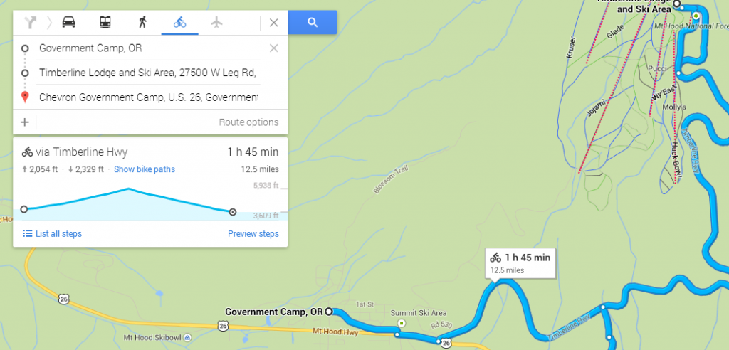
Now with the introduction of elevation data bike riders would be able to easy identify their treks and paths. It’s actually been doing this for some time, but the new widget available now is a chart that shows you the ups and downs between your location and your destination.
If there isn’t much variation here, Google Maps will just say “Mostly Flat” and you won’t get the chart.
And the chart widget doesn’t show up if you map a route for cars, public transit, or walking. But if you want to bike up to a mountain peak, Google Maps is happy to provide. We’ve seen this data visualization before in other travel apps such as AllTrails.
To be honest, AllTrails‘ maps offer more detail; we’d generally still recommend it over Google Maps for hiking and biking, even while Google’s app is arguably the best out there for car navigation.
However, Google’s elevation chart may still be good enough in a pinch, and we wouldn’t blame you if you preferred not to juggle multiple apps when getting around. With Google Maps’ “Explore” function, you may also get notifications about interesting stops along the way, a feature that AllTrails isn’t optimized to handle.
And to make the most of AllTrails, you need to pay a subscription fee, or a $100 for a lifetime license, while Google Maps is 100 percent free to download and use. However, AllTrails isn’t the only hiking and biking app out there.
